As horrible and difficult and frustrating as yesterday was (until McClellanville), today was easy. We left on a rising tide with brilliant sun and no wind (okay, so there were bugs outside, we were inside).
 |
| Shrimp boats in the morning sun. They go back to shrimping Monday |
As good fortune would have it we were on a rising tide all day long - the rising tide just kept preceding us. I don't know what natural magic makes that possible but today it was perfect magic. We made approximately 7.5 knots (8+ mph) all day long!
Yesterday at the swing bridge that didn't, we encountered speed boats. Oh my, they were racing down the stretch of bay that we anchored in to await the bridge opening. Today we saw them un and down the Waccamaw River. They'd arrive out of nowhere and speed past and disappear. Usually 2 people, assumed men, in helmets (good idea but I suspect it was so they could talk to each other), zip by, limited wake because they were barely in the water. There was an instrument on the bow of the boats that reminded me of a hunting bow without the bow part. No idea what that instrument was for. So today we were 30+ miles from the bridge of yesterday and these boats kept zipping buy one way then the other. Speed trials? Friday morning/afternoon zip around? Drug running? Who knows. Impressive though
 |
| speed boat |
 |
| Just the rooster tail is what I usually got |
So there they went - zoom. zoom! to our 8 mph. No telling how fast they were really going.
There was one complicated spot for navigation today. We both remembered that this was a spot coming south that we missed our turn, were heading "safely out to sea" when we discovered our mistake and promptly turned around and found the turn. Such a wide interchange of pathways and possibilities. We saw another boat today that had obviously turned at the wrong place. She corrected. Beyond this large water was Waccamaw River and the WR National Wildlife Refuge. It was board and deep - like 30-40' deep - aaaaahhhhh, especially after yesterday's 5'6" depth. I luxuriated at the helm. There were osprey nests about every 1/10th mile and the those hawks were fluffing their nests.

 |
| osprey at top of dead tree on right |
As the day progressed David did some major navigation calculations to see if we could get through the infamous "rock pile" today. After lots of math, talking to Boats US, more calculations we decided to see where we were (what time) when we reached a particular bridge. So he and the admiral took a break.
 |
| Amelia and David relax |
Amelia continued her break. She's older.
 |
| Admiral Amelia |
We're very aware of Amelia's aging. Post-Marathon we're noticing that she doesn't see or smell as well as in the past. Giving her dry food treats means you have to hold them in your hand then remind her where they are. Now part of this might be her being spoiled but she can't easily find her food and water so I offer it to her then direct her to where it "lives". Also her mis-aligned front ankles give out on some of her jumps down from the bed or the settee and she limps along for a bit. It will be interesting to see how she readjusts to life on land back at 7 Lavers Pond Rd. Will she remember all her old haunts? Will she be able to do the stairs? Will she choose to live on the first floor? The second? And we'll need a litter box on both floors? Will she be comfortable going off the deck? Will she follow us to the pond? We'll see.
So after speed boats, birds and naps it was time to consider the "rock pile" thus named because the ICW here is cut out of rock, I don't know what kind of rock but the sides were cut straight down and the bottom flat. Now rock has fallen into the canal that was cut and sometimes presents major hazards to boating. Our friend, Clint, just earlier this week lost his focus for a moment and ran into a rock that gouged a piece out of his hull and cracked his fuel tank. He got he repair done quickly but was out of the water for 24+ hours. On him way again now. So, caution is necessary. I took us through this on the way south. David did a bunch more reading and we both got a bunch more anxious. He took us through this time with no difficulties other than sweaty armpits and one snarly section when for a moment I had the helm and wasn't centered enough for his comfort. He wanted me to take pics of how scary it is. Unfortunately, the narrowness and shallowness doesn't show up in photos.
 |
| really hazardous part is 6 miles long |
 |
| doesn't look dangerous but that stuff is hard |
You can see that the tide is definitely falling, which allows you to see the rocks but doesn't give much negotiating room for moving from one side to another.
 |
| rocky with marsh grass - pitted rock sort of like coral |
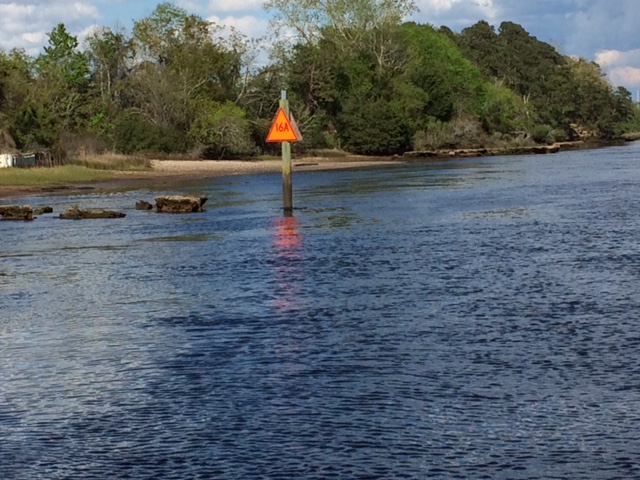 |
| R16 |
This is the most scary place at Red 16. The note says that rocks extend toward the center and are only 3' below the surface. Stay center or slightly to right. Yikes
 |
| approaching R16 |
Photo doesn't really show how narrow the channel is here, maybe 50' across at low tide.
But we made it through, congratulated each other. No boat damages and marriage still intact.
We've been motoring for 8.5 hours today, a looooonnnngg day, for sure about 85 miles.
A good rest and maybe a short day tomorrow.
No comments:
Post a Comment